I was not really looking forward to the next stage of the trip. It had taken Dugald some time to persuade me to agree to a cruise involving several rivers, and some tidal sections. I could only see problems – rain, rising river levels and possible stranding for weeks in the north when we needed to be back in the south. He thought it would be a great adventure, and fun. Boaters are great storytellers, and I eventually managed to put aside the tales of getting stuck on the rivers Soar, Trent and Ouse. I would try his adventure and let the fun begin.
An early start was planned, but delayed by the discovery that in our absence some enthusiast had cable tied our electricity cable to the beams around the marina. It took Dugald some time and much muttering to unscramble this arrangement. We eventually left the marina, and set off down the Soar. The weather looked threatening with dark clouds and a moist feeling in the air fuelling my fears.
We passed a typical group of canal and river horses having fun on the bank. I have never fully understood where these horses come from or who they belong to. We only seem to see them on the edge of waterways.

The Soar had not been very wide up to this point, but now started to widen and become more river like as it flowed towards the Trent.
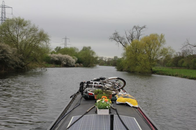
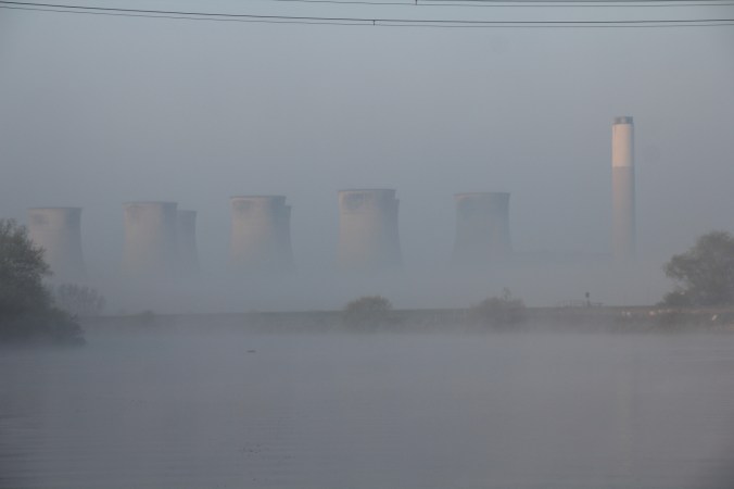
The landscape became more industrial as a power station appeared in the distance.

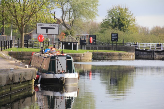
We passed through ‘deep’, ‘shallow’, ‘stop’ and ‘flood’ locks to arrive at the junction where the River Soar flows into the River Trent. I could tick that one off my list.
A left and right turn, and we were heading up the Cranfield Cut towards the Nottingham and Beeston Canal.

As we went into Nottingham along the canal we were passed by a couple of cheery young men on their way to a local spectacle – a couple of ‘lads’ were on a roof chucking bricks and roofing tiles at a number of police in riot gear. We passed the scene shortly afterwards – welcome to Nottingham!

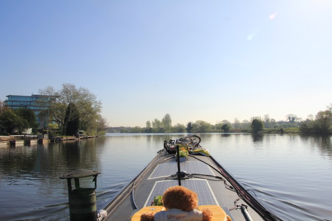
The next morning was bright, cold and sunny, a good day for cruising a large river. We went through Meadow Lane Lock and onto the River Trent, which one of our guides describes as Seine-like, or Rhone-like. A bit of an exaggeration, but it is impressive and wide.
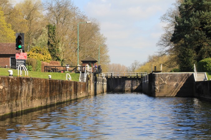
The large locks on the Trent are operated by cheerful and very helpful lock keepers. There is a clear traffic light system on the locks, and we often found a green light as we approached our next lock because the lock keepers at the last lock has radioed ahead to warn that we were on our way.
Exiting the locks, we often joined the flows coming from the weirs, luckily it was less scary than it might appear – I have never fancied white water rafting.

The sun was shining, it was a lovely day, I settled down to enjoy the trip. We saw very few boats on the move, more ‘river’ horses, grazing cattle, sheep and lots of lambs.
At Averham we went past another very large power station,

and just beyond a long unprotected weir. The river conditions were calm, but it is probably very exciting going past when is in spate.

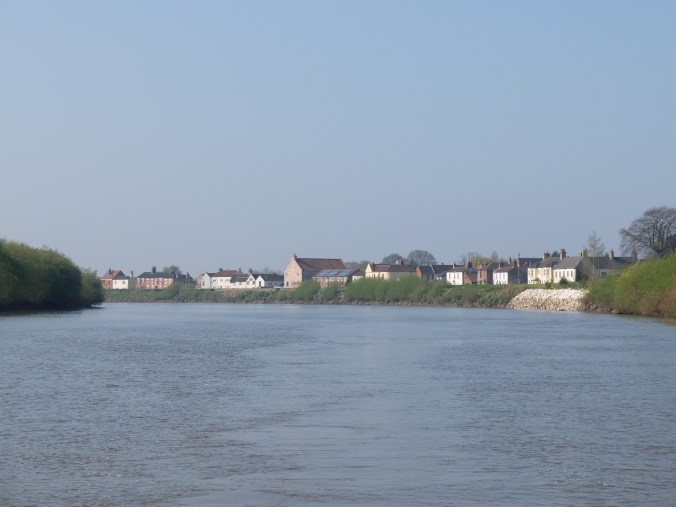
We went through a cut into Newark, and we moored there for the night below the castle. Keith, a former work colleague of Dugald and his wife Karen joined us for an enjoyable supper and catch up on the boat.

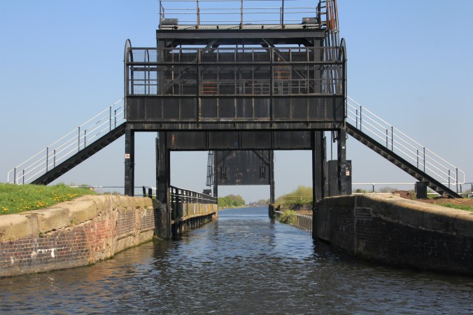
The next day, the forecast was bright and sunny, but the weather was not, and I was feeling apprehensive, we had booked to go through the tidal lock at Cromwell, and would be spending two days on the tidal Trent dodging mud banks. First we had to get to Cromwell. As we got to the first lock the traffic light showed amber, meaning that the lock was not yet manned for the day, and it was self service. We approached with the intention of pressing all the buttons ourselves, but as we rounded the corner between the lock and the weir, the traffic light went red and we did an undignified stop, ending with the boat pointing down the weir! Position recovered, we made up and waited for the light to go green and the gates to open.
On to Cromwell lock where we were expected, we picked up a copy of the excellent River Trent (Tidal) produced by the Boating Association marking all the banks and providing aerial views of the river and landmarks.
Out onto the river by ourselves, no sign of another boat, we went down river with increasing speed, measuring it against helpful km markers on the banks as we went. Dugald skilfully navigated us to Torksey where we were to moor in the lock cut before catching the tide early the next morning.

Dugald had a wander around the edge of Torksey and found a potato field with an interesting ridge pattern. The building in the background is the remains of a sixteenth century manor house which was torched by the royalists in the Civil War and never restored.

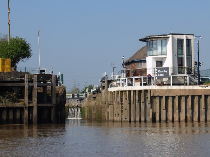
We had contacted the lock keepers at Keadby to book in through the lock, and get their advice about the tides. It was agreed that we would need to catch the tide at 6.45 am.
Dugald decided to get up without waking me and set off. I woke to hear the engine starting, and decided to quickly get up, looked out of a window, and couldn’t see a thing! He had taken an executive decision and set off in thick fog assuming that it would quickly burn off. He knew from many previous ‘discussions’ about fog when sailing in the English Channel years ago that a consultation would have led to a negative response. Unfortunately he misinterpreted which arch of Torksey bridge he was looking at, and at the last minute saw the correct channel and headed for it. Too late, we hit a gravel bank and stuck. Luckily some quick poling got us off and we were away, but the fog stayed with us for some time, lifting at times to show us another power station
and then coming back in banks, slowing our progress.

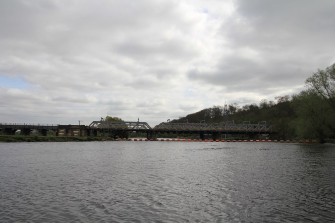
Eventually the sun burnt through. The flow gradually increased as we travelled, and by the time we reached Gainsborough we could see the effect on the bridge supports as we swept past the huge wharves.

We had been travelling alone on the river, but were overtaken by a boat that suddenly appeared behind us and then disappeared into the distance. They slowed down to pass us, and we didn’t have to deal with too much wash.

We passed a few scattered settlements hiding behind large banks and walls.
Passing through the M180 bridge we called Keadby lock to let them know our position.
Half an hour later we had an exciting but successful entrance to Keady Lock. The tide was flowing quite fast by the time we turned in and of course I worried about being swept on down to the Humber, but Dugald ensured that my fears were unfounded. I have to admit, once we got going and the fog cleared allowing the sun to come out, it was quite enjoyable. We had briefly seen one boat, but had had an impression of being alone on the river
We were now on part of the South Yorkshire Navigation, the Stainforth and Keadby Canal. This canal has few locks, but lots of swing bridges to hamper progress. Our first obstacle was a railway bridge which slides in on itself rather than swings. Our guide suggested hooting at the bridge keeper, but the Keadby lock keeper advised against this saying that it would elicit some vigorous hand signals!

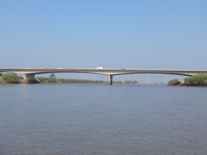
This canal is wide and fairly straight with large fields of wind turbines, and trains running alongside.

Some of the swing bridges have adjacent railway crossings. On these crossings I was surprised to see a crossing keeper coming out of the signal box and close the rail crossing by hand as we closed the swing bridge road barriers before swinging the bridge.

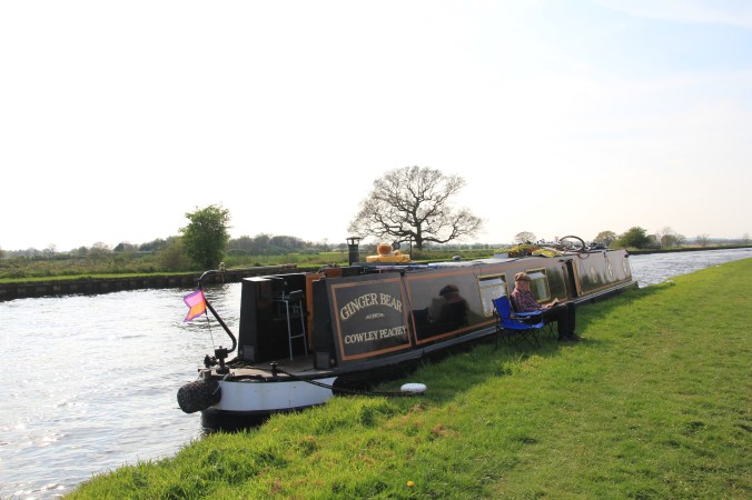
We had to stop at Thorne, the hydraulics on one of the lock gates had broken and a lock keeper would be there in the morning to help us through. We walked through the town to get some food and decided that our guide gave it a better write up than it deserved, but maybe we had walked through the wrong bits. Dugald had agree to attach my new WOB flag to the tiller. WOB stands for Women In Barges, a very friendly and helpful international Facebook group. Members are encouraged to fly their flag so that their boats can be recognised.

A chatty lock keeper helped us through the injured lock the next morning and swung the adjacent bridge for us. He told us that we should just make it to Sykehouse lock on the Grand Junction Canal before the lock keeper went home at lunchtime. It was another sunny day.

At midday we joined the New Junction Canal which is the most recently built inland waterway (1929). It starts with a rather daunting guillotine gate as a small aqueduct crosses over the River Don and in the distance is a series of swing and lift bridges.
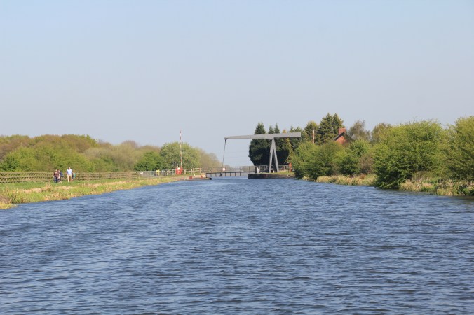
This canal is very straight and very wide, and the bridges all respond to the press of a button. Lots of flashing lights, barriers, chatty walkers, cyclists and annoyed drivers. We could see the Sykehouse lock in the distance, and thought it would be on self service by the time we got there, but the lock keeper had kindly waited for us, and we joined a patient narrowboat in the lock who had been waiting for us as well.
A few bridges later we joined the Aire and Calder navigation just opposite a reservoir where some great dinghy sailing was going on.

This waterway is also very straight and wide, but we immediately noticed a difference, we passed many more boats, mostly river cruisers. We moored a little later and sat on the bank in the sunshine watching the boats go by, and people walking on both sides of the bank.
It was bright, cold and windy the next morning as we continued, through more locks, passing Kellingley Colliery which is now closed and being decommissioned.

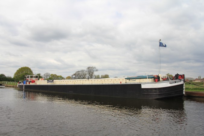
We also saw much larger barges on this stretch.
At Knottingley we left the navigation which was heading on towards Leeds and turned right into the beginning of the North Yorkshire Navigations and onto the River Aire.
There was nothing much to see on the Aire, it seemed to wind around fields with muddy banks for miles. At one of the locks some CRT workmen helped us through, they were getting fed up with pressure washing the cobbled lock top, it had apparently already taken them two days already. The river widened, and became a water ski area, we were grateful that on a dull and windy Monday there was no one coming round the bend at 15 knots with a skier behind. Yet another power station appeared and then we realised we could actually see three at the same time.
There is a flood lock between the Aire and the Selby Canal which was open as we arrived

The scenery immediately changed for the better.

We passed many empty fishing stands as we moved along the canal, apparently at certain times of the year there can be a thousand fishermen lining the banks. I wonder if they like it because there are very few boats on the stretch, or perhaps it is just that the fishing is superb.

We moored in Selby basin and Dugald went to chat up the lock keeper. We had booked passage through the tidal lock to go onto the River Ouse early the next morning.
Having some spare time, we decided to explore this rather attractive town, and its large abbey described by Simon Jenkins as one of England’s best churches.

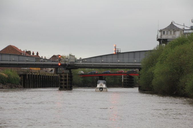
Another early start – the Selby lock keeper spent a lot of time staring intently at the river until he was satisfied the tide was right then we went through the lock with a small cruiser. As we met the tideway she turned up the river and set off at great speed ahead of us. It was a cold grey day with biting wind. We passed quickly under Selby rail and road bridges. Both these bridges swing for large vessels, but we zoomed through underneath.
On up the river, steep muddy banks on either side sharing others’ lost items.

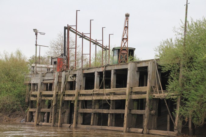
We passed several large working flour mills, but neighbouring wharves appeared rusty and neglected.
Passing through Cawood we met another bridge, Dugald opted for the right hand arch by the pontoon which was ok and did not freak out the bridge keeper – but the Ouse notes recommend the left hand one!

Speeding up the swirly muddy river we arrived at Naburn Lock, the head of the tideway, several hours later as the tide started to slacken.

Through the lock and up the river a little further, we moored at York Marina on a floating riverside pontoon where Ginger Bear would be safe. We were heading south for a few days.


132 miles and 37 locks, 20 moveable bridges
